Exceptional routes
to be enjoyed in moderation
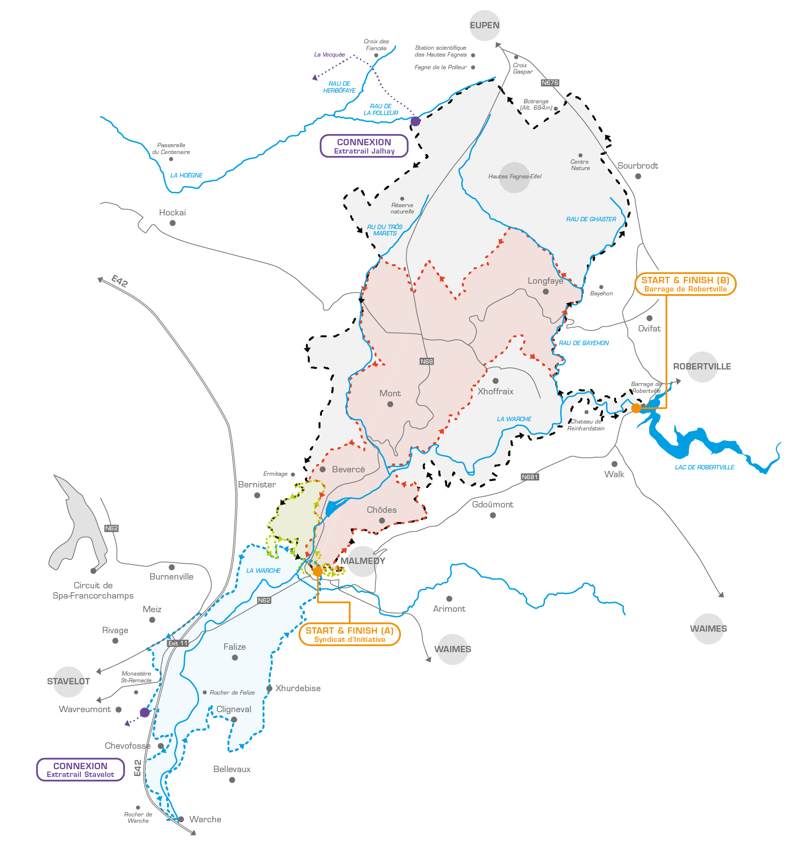
The ExtraTrail concept is now in place in the commune of MALMEDY. The 8, 18, 27 and 39 KM routes and connections to Stavelot and Jalhay are now operational.
IMPORTANT INFORMATION
You can run freely. The use of the trails is the responsibility of the individual. ExtraTrail cannot be held liable for any damage or injuries to users of our trails.
Some structures (bridges or duckboards) or very technical paths are not designed for fast paced travel. ExtraTrail encourages trail runners and Nordic walkers to approach these sections with caution and not to run.
No compensation can be claimed from ASBL ExtraTrail, the owner of the site or the infrastructure manager in the EVENT of an incident or accident occurring along our routes to a user of these structures.
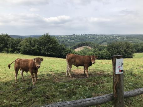
In areas frequented by walkers and families, we highly recommend being friendly and courteous so that everyone can enjoy these often unique spots.
The ExtraTrail trails are designed exclusively for use in the daytime in order to avoid issues with nocturnal wildlife.
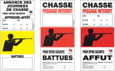
This website gives precise indications of the routes, the state of the paths, precautions to be taken, a weather update, practical information and closures in case of storm warnings or hunts.
The red and black Malmedy routes are entrances to the Hautes Fagnes/Eifel Nature Park. Access is regulated to this very sensitive biotope. During certain periods, a temporary ban on entry to the nature reserve may be posted, for example, due to the risk of fire or in the case of heavy snow.
Never enter this area if the red flag has been raised.
Check the website HAUTES-FAGNES.BE for the current flag colour.
ExtraTrail Malmedy
Green trail
Town centre (Malmundarium - Tourist Office)
Blue trail
Town centre (Malmundarium - Tourist Office)
Red trail
Town centre (Malmundarium - Tourist Office)
Black trail
A: Town centre (Malmundarium - Tourist Office)
B: Lake Robertville dam
Connection Malmedy-Stavelot
Connection Malmedy-Jalhay
GOOD TO KNOW
The Malmedy’s trails have been carefully developed in close collaboration with a team of passionate trail runners and organizers of well-known events such as the Trail des Hautes Fagnes and Trail des Idylles. These trails offer a wide variety of landscapes and a range of technical difficulties. They were created using the "Sity Trail" platform and ground signs with easily-identifiable markers.
The 4 Malmedy trails (green 8 KM, blue 18 KM, red 27 KM and black 39 KM) begin in the town centre by the Tourist Office - Malmundarium (Place du Châtelet – GoogleMaps), by the Saint-Pierre Cathedral.
A second point of access for the black trail (39 KM) is from the Lake Robertville dam - GoogleMaps.
You can take a shower at the Malmedy Sports Centre for €1.50 per person. How does it work? Send a booking enquiry to hall.sport@belgacom.net, specifying the date and approximate arrival time (at least 48 hours in advance). The secretary will then confirm if there is any availability. A supervisor will be there to direct you and provide access to the changing rooms.
Malmedy Centre Sportif
Avenue du pont de Warche, 1 - 4960 Malmedy
080/799.050 - hall.sport@belgacom.net
The Malmedy trail
WHEN NATURE GOES HAND IN HAND WITH ADVENTURE

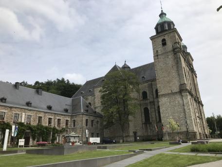
The history of Malmedy dates back to the 7th century when the town was built around a monastery founded around 648 by Saint Remacle, a Prior originally from Aquitaine (France).
From the 16th century, several industries developed in Malmedy (tanneries and draperies). Together with its neighbour, Stavelot, it became one of the largest tannery centres in Europe during the 17h century.
Malmedy’s great importance in this industry derived from its geographic location. Nestled in the heart of large forests, Malmey’s abundant source of tannin as well as the two rivers (the Warche and the Warchenne) were essential in providing the hydraulic energy required to operate the mills. The history of Malmedy (including museums, themed exhibitions and much more) can be discovered in an attractive and interactive manner at the Malmundarium.
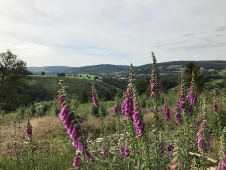
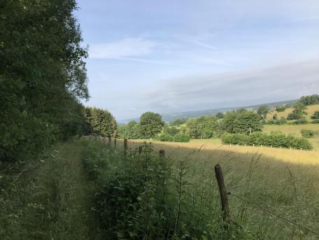
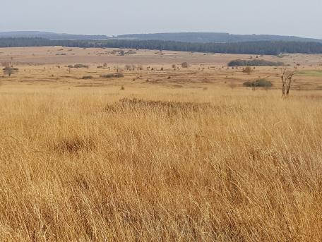
At the entrance to the Haute Fagnes, Malmedy is characterised by incised valleys, where turbulent streams formed small waterfalls to join the Warche and, further along, the Amblève. By following these small watercourses, we come to the Haute Fagnes plateau and its almost desert-like vast expanses resembling steppes.
Slow down your walk, open your eyes wide, listen and be enchanted by the songs of birds, the sound of the running stream and the whistling of the wind around the high plateaus.
Comment
Wed, 07/04/2018 - 08:34
Wed, 07/04/2018 - 09:23
Sun, 07/22/2018 - 19:41
Sat, 07/28/2018 - 19:09
Thu, 07/26/2018 - 10:28
Sat, 07/28/2018 - 16:34
Sun, 09/30/2018 - 10:49
Mon, 10/01/2018 - 06:45
Sun, 10/07/2018 - 15:06
Sun, 10/07/2018 - 15:14
Sun, 10/07/2018 - 17:25
Sat, 11/03/2018 - 16:57
Sun, 11/04/2018 - 10:22
Thu, 11/22/2018 - 11:23
Thu, 11/22/2018 - 11:25
Fri, 03/08/2019 - 09:58
Fri, 03/08/2019 - 10:18
Thu, 04/18/2019 - 13:22
Thu, 04/18/2019 - 16:07
Thu, 09/19/2019 - 08:18
Thu, 09/19/2019 - 08:24
Fri, 01/31/2020 - 23:26
Sat, 02/01/2020 - 10:24
Mon, 05/18/2020 - 21:56
Tue, 05/19/2020 - 06:28
Wed, 05/27/2020 - 12:03
Wed, 05/27/2020 - 12:12
Sun, 09/16/2018 - 08:37
Sun, 09/16/2018 - 11:47
Sat, 10/06/2018 - 21:31
Sat, 10/06/2018 - 21:41
Fri, 11/16/2018 - 21:49
Sat, 11/17/2018 - 09:17
Mon, 04/15/2019 - 19:44
Mon, 04/15/2019 - 19:58
Mon, 05/20/2019 - 14:59
Fri, 06/07/2019 - 12:43
Fri, 08/16/2019 - 19:22
Sun, 08/18/2019 - 08:34
Mon, 08/19/2019 - 11:03
Mon, 08/19/2019 - 11:18
Mon, 01/13/2020 - 14:27