Description of the trail
Trois-Ponts tourist information office
Practical guide
AND TIPS
Work is currently underway at upper and lower Coo lakes. The black route of Trois-Ponts has been diverted for several weeks. + News here.
So, are you ready for a great adventure? Beyond its 37 KM and 1020 m D+, the Trois-Points black trail is a splendid journey through wild and generous nature.
Leaving from the Syndicat d’initiative and close to the Carrefour Market, you quickly leave the centre of Trois-Ponts by taking two small roads which take you up slightly (Rue des Villas then Rue Willy de Backer). A stone path then winds along the hillside to take you to a lake, home to a family of beavers. A good 250 metres after the water course, head down from the main road to reach a narrow bridge (be careful: the path is short but steep and may be slippery). Cross the small stream and leave a pouhon (source) on your right.
When reaching the N66, take a right-left (KM 2) to take a country lane which climbs between the meadows towards the village of Mont-de-Fosse. When the tarmacked road turns left, leave the road to the right, then take a road at the edge of the forest.
At KM 3.6, leave the green trail and cross a stream over a small blue bridge. Continue to your right for approx. 150 metres before turning left onto a single track (wet) which takes you to the summit of a hilltop. When you get there (KM 4.6), take a right angle on your right to head down a forest road until you reach a small water course which you need to follow for a good kilometre to the hamlet of Reharmont.
In the village of Reharmont and a little after Brasserie de la Lienne, turn right onto a forest road and turn off to the right almost immediately via a barely-visible, wet path intersected by various felled trees. This natural gymkhana takes you to a paved road which leads you down to a T-junction. Turn right and continue your descent to Baleur bridge (water course). After climbing for a few metres, you’ll reach the crossroads with the N651 (Basse-Bodeux - Les Vilettes). Be careful here: the speed of the vehicles and lack of visibility means you are particularly exposed. Be very cautious.
After having turned left and followed the N651 for approx. 200 metres (KM 9.7), turn right and take a forest road which will take you to the centre of "Derrière les Avenanterres".
Further along, you leave the small section of road that you have just travelled along on your right, to follow alongside the hunting shelters. Follow this for 2 KM of pure joy along lovely paths where the vegetation is within touching distance. At KM 13, at a gas pipe, continue along the stone path at the end of which you need to turn left. There is a wide panorama to enjoy while you descend towards a small former quarry (KM 14.6). Don't get too close to the large oak with burls in the corner, as there is a hornets’ nest there. Without air defence, it is best to avoid bothering these “bombers”, whose bite can be fatal for even the most experienced of trail runners.
After several changes in direction along a road which zig-zags between the softwoods, follow the curves through the woodland to KM 16. Follow a splendid barely-visible single track until you reach the N66. Turn right along a stone road which is easy to spot thanks to the gas pipe and its triangular panels allowing for helicopter surveillance.
You arrive at a small triangular road junction, turn left and cross the N66 to get to L'Ancienne Barrière campsite. Take care at this very dangerous crossing. The road is S-shaped and offers no visibility for pedestrians or drivers, who go by very quickly.
Follow the campsite on the right and continue to a T-junction with a forest road, turn right and follow the ridge line for 4 KM. The Stoumont running territories are on your left.
At KM 22.5, when you pass the fence for the upper lakes of the Coo electricity plant (Engie-Electrabel), keep the ponds to your right before descending towards the lower lake and re-joining the blue trail which weaves around a ledge overlooking the main water course.
A very technical descent (exercise caution) takes you to the edge of the lower lake which you will almost complete a tour of by covering the inside of the C (the water course is in the shape of a horseshoe).
Note: at KM 29.3, a 400-metre connection allows you to join the red (23 KM) and black (40 KM) Stavelot trails at the bottom of the famous chairlift ride. If the climbing wasn’t enough of a challenge for you, this option offers dizzying sensations.
Shortly after passing the second wall of the lower dam, climb to enjoy the exceptional view of Coo village and its lake.
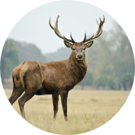
Take a breather because the difficulties are not over yet. It is only when you arrive at the large pasture, where you will perhaps have the chance to observe the local game, that you will be able to let out a sigh of relief. There are just 4KM to go before you reach Trois-Ponts and return to your departure point.
Advice
Food and drinks mandatory.
Mobile phone and survival blanket highly recommended.
Be careful when crossing the N66 at L'Ancienne Barrière campsite. This area is particularly dangerous due to the lack of visibility.